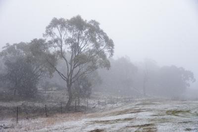
SYDNEY, Feb. 3 . While a cold snap has brought summer snow to parts of southeast Australia, people in the state of Queensland are sweltering through heatwaves.
In a statement released on Friday, the Bureau of Meteorology (BOM) forecasted mixed and extreme weather conditions across the country.
A strong cold front associated with a deep low-pressure system swept across much of southeast Australia on Thursday, bringing a burst of cold air as well as showers, localized hail, thunder, and strong gusty winds.
There was snow overnight in the Alpine areas of New South Wales (NSW) and Victoria, and snow showers will likely continue in these areas, said the bureau, adding that southeast Australia will also see maximum temperatures are as much as 10-16 celsius degrees below average for February.
Meanwhile, heatwave conditions continue in eastern Queensland, with a severe heatwave warning current for areas south of Proserpine. Conditions will begin to ease from Sunday.
Before 9:00 a.m. local time, the temperature in Brisbane, the capital of Queensland, already cracked 30 celsius degrees.
The BOM noted that as hot and gusty winds will move over north-east NSW and south-east Queensland, temperatures are likely to hit the high 30-celsius degrees to low 40 celsius degrees on Friday and Saturday, which could result in elevated fire dangers and heatwave conditions.
In NSW, extreme weather events triggered multiple warnings of marine wind, severe thunderstorms, floods, fire dangers and for sheep graziers in snowy mountain districts. ■

